- Recent flights over Lake Arrowhead
- Recent night flights over Lake Arrowhead
- Violations of the FAA 2018-01-25 announcement
- Approach routes into Ontario
- download csv data file
- Some flight path statistics
- Questions for the FAA and SB County
- 5 minute video showing multiple aircraft over Lake Arrowhead
- 2 minute video showing the change in flight patterns over Lake Arrowhead over the last two years
Page 9 of the FAA presentation is so misleading that it is just incorrect. “The JCKIE flight track falls within historical ZIGGY flight tracks” That is true if you only consider the part south of Highway 18.
The graph from page 9 of the FAA presentation:
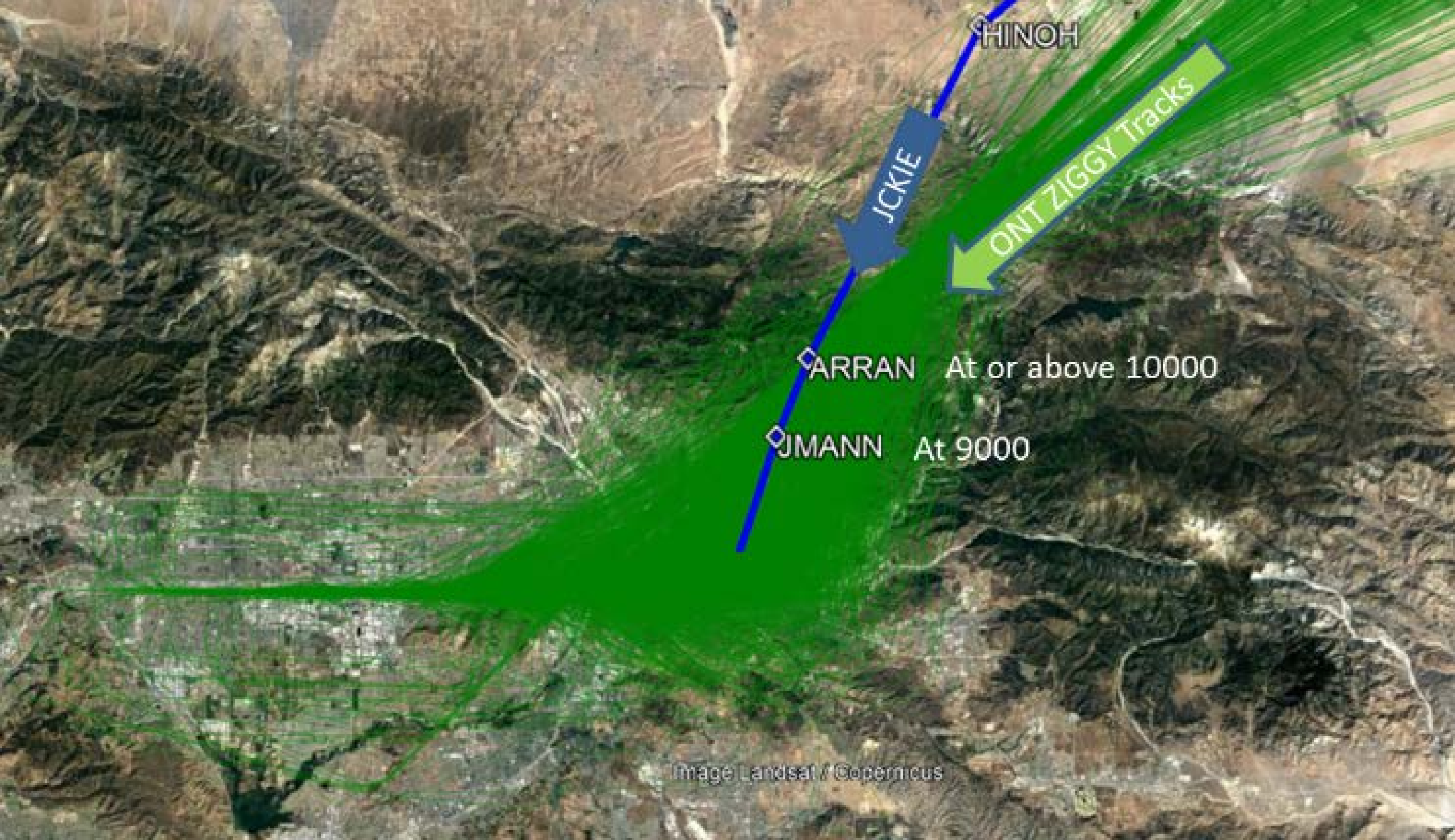
Note that most of the ZIGGY7 flight tracks on that graph are significantly south-east of the actual ZIGGY7 route. This is a fundamental flaw with this type of graph. It might be the case that almost all those flights are very close to the ZIGGY7 route, but enough of them are spread out to the south-east to completely color in that area.
The location of Lake Arrowhead and surrounding communities is nicely
obscured by all the green flight tracks. With some image processing, we
can show that:

Hook Creek is 1.35 miles from ZIGGY7, but 0.45 miles from JCKIE1. Cedar Ridge is 1.22 miles from ZIGGY7, but 0.68 miles from JCKIE1. That extra 0.5 mile makes a big difference in noise level. As far as the communities of Hook Creek and Cedar Ridge are concerned, the JCKIE1 route is NOT within historical ZIGGY7 flight tracks.